
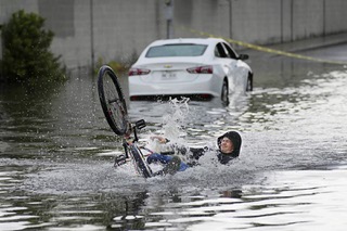
John Locher/AP
Clark County Fire Department officials searche for a man who was trapped in floodwaters in a flood channel Friday, Sept. 1, 2023, in Las Vegas.
Published Friday, Sept. 1, 2023 | 2:02 p.m.
Updated Friday, Sept. 1, 2023 | 10:42 p.m.
Clark County is under a flash flood warning this afternoon and will remain at risk into the evening, according to the National Weather Service in Las Vegas.
The service at 4:08 p.m. reported that 1.75 inches of rain had fallen.
Las Vegas valley residents and visitors were being asked by National Weather Service to stay off the roadways through 9 p.m.
“There have already been several rescues, stranded vehicles, flooded intersections etc. and the west side of the Valley especially could get hit hard,” meteorologist Traver Boucher said.
The county urged travelers to avoid areas around Allegiant Stadium, Tropicana, Decatur and Russell and that section of I-15 as the rain continued to fall late Friday and water levels were continuing to rise in the Tropicana Detention Basin.
A flash flood warning for Northwest Clark County was issued by National Weather Service until 7 p.m. This includes Highway 95 in Clark County between mile marker 93 and 114 and Lee Canyon Road between mile marker 13 and 17.
A warning for Central Clark County was extended to 6:45 p.m. by the National Weather Service Las Vegas.
At 4:10 p.m. the Weather Service extended a flash flood warning for areas including Las Vegas, East Las Vegas and Harry Reid International Airport until 6:30 p.m. The warning stated the area had seen up to one inch of rain and that flash flooding was already occurring.
The flash flood warning for West Central Clark County has been extended until 9:30 p.m. The area had seen up to 1.5 inches of rain by 5:30 p.m. It includes Las Vegas, The Strip, Downtown Las Vegas, Summerlin, Green Valley, Blue Diamond, East Las Vegas, Sam Boyd Stadium, Centennial Hills and Nellis AFB.
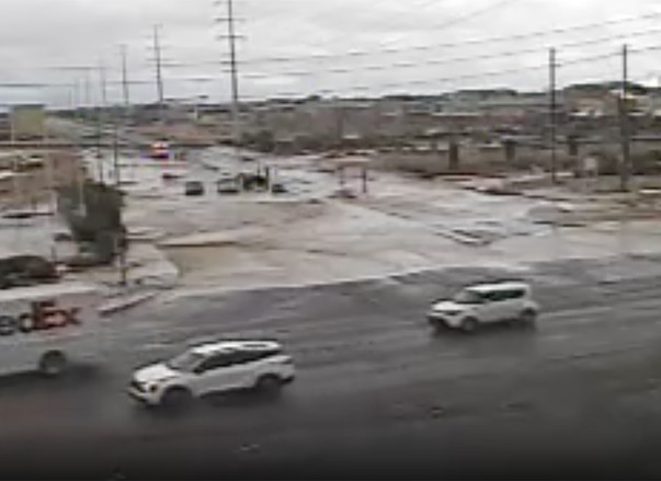
Flooding can be seen on Rainbow Boulevard, in a northeast view from Blue Diamond Road in a video capture at about 4:45 p.m. on Friday, Sept. 1, 2023, in Las Vegas.
Some other areas that already have or could experience flash flooding include Henderson, South Highlands, Enterprise, Anthem, Paradise, Green Valley, Sloan, Seven Hills, Silverado Ranch and Henderson Executive Airport.
NVEnergy was reporting about 4,000 power outages as of 6 p.m. Friday. About 3,500 of the outages were off W. Russel Road in the Spring Valley area.
The thunderstorms are bringing high winds and hail, with 62 mph wind gusts reported at Warm Springs Road and Buffalo Drive in Southwest Las Vegas. The National Oceanic and Atmospheric Administration reports quarter-sized hailstone.
The weather service warned that “hail damage to vehicles is expected. Expect wind damage to roofs and trees.”
The storms come as Las Vegas is welcoming visitors to the region for the three-day Labor Day weekend. At least one notable event — First Friday in downtown Las Vegas — has been reportedly called off, officials said.
The series of storms rolling through the area could dump up to an inch of rain by Saturday, said Brian Planz, a meteorologist with the service.
Planz said the Las Vegas Valley will see the highest potential for rain fall until about 9 p.m. Friday.
More rain is predicted for Saturday but won't produce flooding in the Las Vegas Valley, he said.
Mount Charleston, which continues to repair damage from Hurricane Hilary, had seen minimal rainfall at about less than a tenth-of-an-inch.
Planz said drivers should use caution if traveling Friday in Clark County. He said drivers should avoid driving through any water on roadways.