Mount Charleston Fire Protection District/Clark County Public Information Office via AP
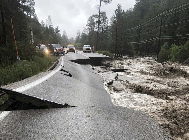
This photo provided by the Mount Charleston Fire Protection District via the Clark County Public Information Office shows an asphalt road separated in Mount Charleston on Monday, Aug. 21, 2023, after upwards of five inches of rain battered the area west of Las Vegas from Tropical Storm Hilary.
Thursday, Oct. 26, 2023 | 7:02 p.m.
The Nevada Department of Transportation announced in a news release that State Route 156 (Lee Canyon Road) will be the first road at Mount Charleston to reopen to the public tonight following emergency repairs that have been under way since an August storm caused historic damage.
Officials stated that visiting public and residents should remember that active construction work continues in residential subdivisions of Kyle Canyon, including Forest Service work in channels, roads and trails, and recreation areas.
The Las Vegas Valley Water District continues to work in Old Town to restore water to about 35 properties.
Clark County’s Public Works Department completed repairs and repaving work on Echo Canyon Road and is now doing repairs at the entrance of the Rainbow subdivision.
There still are some open trenches near roadways in the Old Town area that need to be filled in, according to the release.
“It’s very important for the public to realize that with the opening of the highways to Mount Charleston, there is still a lot of active construction work under way and many of the popular trails and picnic areas remain closed due to storm damage,” stated Jason Douglas, Assistant Fire Chief of the Mount Charleston Fire Protection District. “We have serious concerns about people getting injured if they attempt to access closed areas. We are asking the public to be cautious when you visit the area and to obey the Forest Service’s closure notice.”
The Mount Charleston area experienced heavy damage to roads and structures due to flash flooding from the remnant of Hurricane Hillary in late August.
The Humboldt-Toiyabe National Forest stated it will reopen of 99 percent of the Spring Mountains National Recreation Area over the next two weeks. Forest employees, partners, and volunteers have been working since Aug. 17, based on the storm weather forecasts, to keep visitors and employees safe.
“While significant work is still needed to assess, stabilize, reroute, rebuild, fund, and repair areas that were obliterated by this 1,000-year storm, the reopening of so many areas before the winter season is an exciting milestone,” stated Deb MacNeill, Spring Mountains National Recreation Area Manager.
While 99 percent of the nonseasonally closed Forest areas will be reopened Friday, vehicular access is limited in the Kyle and Deer Creek areas due to ongoing highway and infrastructure construction, the release stated. Some popular roads, trails and recreation areas will remain closed for an extended period due to the extreme damage.
Closure areas that remain include: the Mary Jane Falls, Echo, Trail Canyon, Cathedral Rock, and Bristlecone Pine Trails; Deer Creek picnic area; Mack’s Canyon dispersed area, and FS Roads 45085, 45085A, 450855B, 45577, 45577A, 25872, and 25873. Additional details and an updated Closure Order, will be posted online Friday at https://www.fs.usda.gov/htnf.
