
Courtesy Ed Gaither
Lightning flashes behind the Stratosphere as seen from the Newport Lofts in this photo submitted by Las Vegas Sun reader Ed Gaither, Friday, July 19, 2013.
Published Friday, July 19, 2013 | 7:42 p.m.
Updated Saturday, July 20, 2013 | 12:30 a.m.
Rain and wind in Henderson
Rain and wind at Desert Pines High School
Video of the storm at Manadaly Bay
Roof leak at Gilley's Bar
Video from downtown
More video from the Strip
Rain on Sunset Road in Henderson
A thunderstorm swept through the Las Vegas Valley Friday night, setting a rainfall record, causing floods and power outages throughout the area, setting a house on fire and displacing some residents of an apartment complex.
For a little more than an hour, torrential rain and 70 mph gusts of wind whipped through the valley. The storm dumped an average of 0.4 inches of rain across the valley, with some areas receiving up to an inch, National Weather Service meteorologist Todd Lericos said. Flash flood warnings were in effect in different parts of the valley from before 7 p.m. until at least 11:45 p.m.
McCarran International Airport, the valley's main weather station, received 0.22 inches of rain, setting a record for July 19, the service said. The previous record was 0.17 inches, set in 1951.
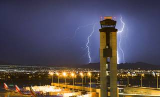
Between 7 p.m. and 10 p.m., there were 741 cloud-to-ground lightning strikes in the area, the service tweeted.
The sudden downpour left the valley scrambling.
The storm displaced 40 to 50 people from their homes at Atrium Garden Condos at 3516 Folage Drive, near Washington Avenue and Pecos Road. The storm snapped trees in half with some trees falling onto 12 apartment units, Las Vegas Fire and Rescue spokesman Tim Szymanski said. Gas and power were shut off at the complex until damage could be repaired and the trees removed.
The American Red Cross set up an evacuation center at Desert Pine High School for the displaced residents. School buses arrived about 10:50 a.m. to transport the evacuees, Szymanski said. Thirteen residents chose to relocate to the shelter. No one was injured in the incident.
A Henderson home near Anthem Parkway and Somersworth Drive caught fire about 8:50 p.m. after a lightning bolt struck it, Henderson Fire Battalion Chief Scott Satterlee said. Henderson Fire arrived to find light smoke coming from the roof, and quickly extinguished the fire. The fire caused about $5,000 in damage to the home, but no one was injured, Satterlee said.
Meanwhile, there were 15 power outages scattered throughout the valley, said NV Energy spokeswoman Kelley Mulroy. The utility later tweeted that 33,000 customers were without power. Many areas had power restored by 11 p.m.
The Clark County Fire Department assisted motorists who stalled in water at Desert Inn and Mojave roads, about three miles east of the Strip, fire officials said.
Szymanski said there were numerous other calls for help due to down wires and fallen trees.
The storm began near Nellis Air Force Base and worked its way southwest along the Interstate 15 corridor, Lericos said. Mount Charleston did not receive any rain, but few areas inside the valley were spared.
Metro Police said flooding impeded traffic at the intersections of Sahara and Burnham avenues, Maryland Parkway and Sierra Vista Drive, Valley View Boulevard and Reno Avenue and Lake Mead and Lamb boulevards, in addition to minor flooding throughout the region.
Several bad leaks caused by the storm forced the closure of Gilley's Bar and a Starbucks at Treasure Island.
"There was no structural damage," said Michelle Knoll, Treasure Island's vice president of communications. "We had several bad leaks on the dance floor."
A YouTube video shows water pouring from the ceiling of the bar onto the dance floor.
Knoll said the bar and Starbucks would open Saturday morning after crews clean up the mess.
While the majority of Friday's storm was over before 10 p.m., the risk of dangerous weather this weekend isn't over. The Weather Service has also issued a flash flood watch from Sunday afternoon through Monday evening, when thunderstorms may return and bring flooding to the region again.
There is a 30 percent chance for thunderstorms on both Saturday and Sunday, Weather Service meteorologists said.
That likelihood doubles on Saturday for Mount Charleston. U.S. Forest Service officials cautioned visitors of flash floods in the area in the case of a thunderstorm. A wildfire that charred 28,000 acres of forest and vegetation makes the area more susceptible to flooding, said Jon Kohn, public information officer for the incident command team.
Las Vegas Sun reporter Ed Komenda contributed to this report.
Join the Discussion:
Check this out for a full explanation of our conversion to the LiveFyre commenting system and instructions on how to sign up for an account.
Full comments policy