Dan Marschka / AP
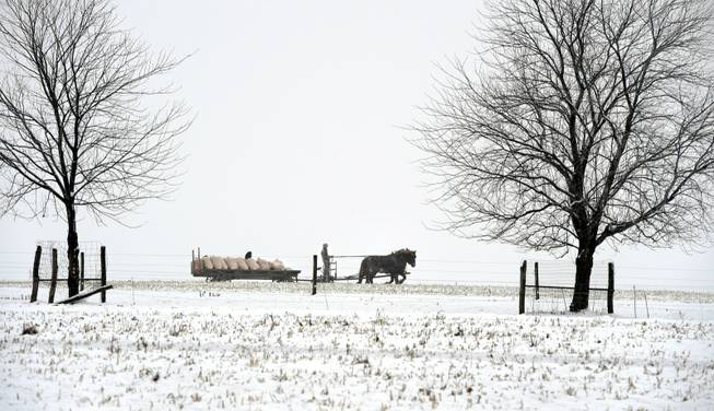
A man hauls farm cargo with a horse-drawn carriage in Leacock Township, in Lancaster County, on Saturday, Jan. 24, 2015. Overnight snow brought wet, slushy conditions to the area.
Published Saturday, Jan. 24, 2015 | 2:27 p.m.
Updated Saturday, Jan. 24, 2015 | 4:12 p.m.
BOSTON (AP) — Parts of the Northeast got their first real taste of winter Saturday as a storm crawling up the coast left a slushy, snowy coating from Pennsylvania to New England, but forecasters are watching a possible second shot of snow that could affect the region early in the work week.
By midday, the storm had dropped 9 inches in parts of Pennsylvania and 8 inches in parts of New York, northern New Jersey and northwestern Connecticut, with widespread reports over 4 inches in inland areas across the southern New England region.
Lighter amounts were reported in Philadelphia, New York City and Boston.
The storm was expected to drop up to 8 inches in far eastern Maine before moving out late Saturday night.
Numerous accidents were reported on the slick roads but no major highway backups in the lighter weekend traffic. Police in Connecticut and Massachusetts were investigating the weather's role in traffic accidents that killed two people Saturday afternoon.
Rain and sleet mixed in with the snow in areas that saw above-freezing temperatures nearer to the coast, keeping totals down in those areas before the storm began to taper off.
"It's not really bad out there, as long as you don't drive like a maniac," Vernon Forrest of Manchester, New Jersey, said while getting some coffee and a sandwich at a convenience store in Toms River. "The road crews did an excellent job and we got more rain and sleet here than snow, so it's mostly just wet roads. So just keep an eye out for slippery, slushy spots and speeding knuckleheads."
But people were urged to watch for icy roads as temperatures dropped below freezing into Sunday morning.
Winds gusting to 50 mph were expected on Cape Cod and nearby islands Saturday night as the storm moves away.
Another system beginning Sunday night into Monday is expected to drop another inch or two across Pennsylvania, with a potentially bigger one behind it late Monday.
"There is an increasing possibility of a significant storm late Monday night into Tuesday night," said National Weather Service meteorologist Bill Simpson in Taunton, Massachusetts, adding that there's still much uncertainty this far ahead. "It's how it evolves once it develops."
He said there is the potential that a storm moving up the East Coast could stall before it tracks out to sea, bringing high wind, heavy precipitation and the potential for coastal flooding.

Join the Discussion:
Check this out for a full explanation of our conversion to the LiveFyre commenting system and instructions on how to sign up for an account.
Full comments policy