
A Mercedes sedan is partially submerged in mud in the median of Interstate 15 near Glendale Tuesday, Sept. 9, 2014. About 1 mile of freeway was severely damaged by runoff from Monday’s storm. The Nevada Department of Transportation expects to have two lanes open by the weekend, a spokesman said.
Wednesday, Sept. 10, 2014 | 4:25 p.m.
Related news
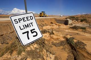
Repairing a stretch of Interstate 15 destroyed in Monday’s massive flooding will cost $5 million, Nevada Department of Transportation officials said today.
I-15 is closed for nearly 50 miles between Apex and Mesquite. The transportation department hopes to have at least one northbound and one southbound lane open by Friday, NDOT spokeswoman Julie Duewel said.
Until then, the Nevada Highway Patrol has set up three detour routes:
Heading north: Motorists traveling north on I-15 should exit at mile marker 75 and take Valley of Fire Road to State Route 169. SR 169 eventually intersects with I-15 past the blocked section.
From Henderson or the East Valley: Take State Route 147 to Northshore Lake and then exit at State Route 169, which will hit I-15 and avoid blocked roadways.
Any vehicles other than standard passenger vehicles — cars, minivans and pickup trucks — will be turned away, Nevada Highway Patrol Trooper Chelsea Webster said.
Toward Cedar City: Vehicles headed north toward Cedar City should exit northbound I-15 at exit 64 near Love’s Truck Stop and take U.S. 93 toward Utah State Route 319, which becomes Utah Highway 56. This detour route is 247 miles, adding 77 miles to the normal trip.
Toward St. George: Motorists headed toward St. George can take Utah Highway 56 to State Route 18. The detoured route to St. George is 260 miles total, adding 140 miles to the normal route.
In addition to the extra mileage, the detour routes have been plagued by heavy traffic since Monday, meaning travel will be both long and slow.
Construction on the I-15 is being done by crews from Panaca, Alamo, Ely and Las Vegas. The transportation department has had crews working around the clock.
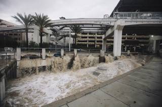
Meanwhile, the Moapa area, which was hit hardest by the flooding, has been slowly recovering.
Though much of the Moapa Valley remains covered in mud and debris, most of the actual flood water has drained into the Muddy River, Clark County Regional Flood Control District spokeswoman Erin Neff said.
Gov. Brian Sandoval on Tuesday declared a state of emergency for Clark County and the Moapa Band of Paiutes Reservation, allowing local governments to qualify for state and federal assistance, according to a media release from the governor’s office.
The declaration will also allow the state to expedite its response to requests from local jurisdictions.
Also on Tuesday, the Clark County Commission — seeking funding for disaster cleanup — announced it would consider a resolution at a Sept. 16 meeting to declare a state of emergency because of the flooding in Moapa, Moapa Valley and Sandy Valley.
A disaster assessment team went to Moapa Valley this morning to determine the degree of damage done to homes there. Flood damage has been reported in the southern part of Overton, located southeast of Moapa Valley, on Alma Deer and Spur streets, Clark County spokeswoman Stacey Welling said.
The results of the assessment have not yet been released.
Join the Discussion:
Check this out for a full explanation of our conversion to the LiveFyre commenting system and instructions on how to sign up for an account.
Full comments policy