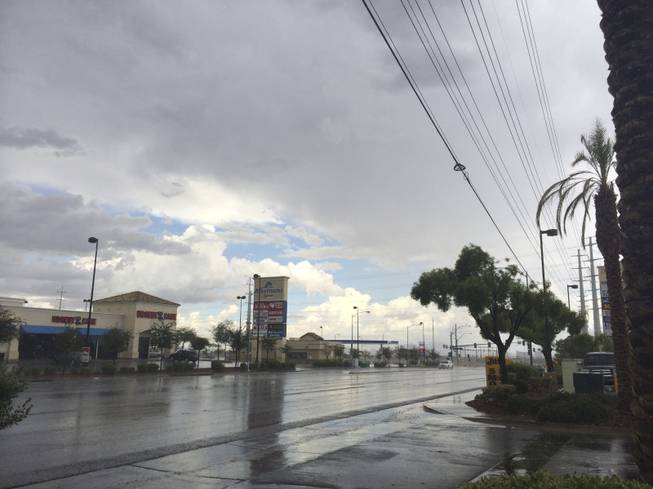
A storm runs through the Las Vegas Valley, as seen from the 8600 block of West Flamingo, on Sunday, Sept. 7, 2014.
Monday, Sept. 8, 2014 | 8:41 a.m.
Valley residents hoping for a break from the rain will likely have to wait until Wednesday for dry days.
There is a 70 percent chance of rain for most of the valley Monday and a flash flood watch that began Sunday will be in effect until 5 a.m. Tuesday, according to the National Weather Service.
Parts of the western valley flooded Sunday as 0.6-0.7 inches of rain fell in about 30 minutes. Summerlin also saw some nickel-sized hail by the 215 and Charleston Boulevard, according to the National Weather Service.
Much of the moisture is due to post-tropical cyclone Norbert, which was downgraded from hurricane status this weekend .
Conditions are expected to clear up later this week as the moisture moves east.
"Tomorrow drier air is going to start moving in, but we still have a slight chance of thunderstorms," weather service meteorologist Jim Harrison said Monday.
Most areas in the valley have a 40 percent chance of showers and thunderstorms Tuesday. That rain is expected to happen before 11 a.m., according to the weather service.
There is also an 80 percent chance of rain for Mount Charleston on Monday and a 50 percent chance for showers and thunderstorms in the area Tuesday.
The Clark County Regional Flood Control District warned residents to avoid flood channels and basins experiencing heavy runoff due to rains.


Join the Discussion:
Check this out for a full explanation of our conversion to the LiveFyre commenting system and instructions on how to sign up for an account.
Full comments policy