
A thunderstorm passes through the western Las Vegas Valley on Sunday, July 28, 2013. Heavy rains from the storm prompted a flash flood warning for central Clark County.
Published Sunday, July 28, 2013 | noon
Updated Sunday, July 28, 2013 | 7:09 p.m.
Sun weather coverage
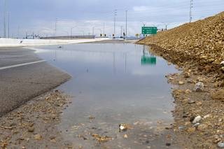
Flash flood warnings were issued Sunday for multiple parts of the Las Vegas Valley, according to the National Weather Service.
Flash floods are expected near area roadways and in normally dry washes and low-lying areas.
One warning in effect until 7 p.m. was issued for west central Clark County, including the area of Mount Charleston where a wildfire recently burned 28,000 acres.
Just after 6 p.m., the weather service reported that another round of rain appeared to be headed for the burn area.
"Any heavy rain which falls on the burn could result in flows of mud and ash," the warning stated. "Because of the lack of vegetation, water levels will rise much more rapidly during flash floods, leading to an increased rise of mud and debris flows in and downstream of this burn area."
Pahrump is also under a flood warning. According to the weather service, at 6:16 p.m., weather spotters reported flash flooding in the area that left cars floating in 3 feet of water at the intersection of Gamebird Road and Malibou Avenue. Rain was tapering off, but another round of heavy rain was moving out of Death Valley toward Pahrump, the weather service reported.
Severe thunderstorms northwest of Centennial Hills began around 1:23 p.m. Sunday, with some parts of the area receiving up to 0.6 inches of rain in less than 10 minutes, the weather service announced. Locations impacted include Kyle Canyon Road and a part of U.S. 95 northwest of Las Vegas.
The weather service reported a total of 1.81 inches of rain collected in 15 minutes near Mesa Park, with several feet of flood water in the area.
At around 2:30 p.m. Sunday, the Regional Transportation Commission issued an alert for the southbound 215 Beltway at Flamingo Road, saying the roadway was flooded, causing vehicles to stall and the offramp to be blocked.
Due to the severe weather, several incoming flights at McCarran International Airport are facing delays up to an hour, according to the Federal Aviation Administration's website.
General departure delays, which include gate and taxi traffic, are between 15 and 30 minutes and increasing.
A flash flood watch for parts of California, Nevada and Arizona was issued Sunday morning due to possible thunderstorm creation throughout the area.
The watch, which affects portions of Clark County — including Lake Mead National Recreation Area, the Spring Mountains, the Las Vegas Valley and Red Rock Rock Canyon — is in effect until 10 p.m. Sunday, according to the weather service.
The flood watch comes as the combination of heat and monsoon moisture threatens to build up thunderstorms that can drop up to 1 inch of rain in an area in a short period of time, the weather service said.
Thunderstorms caused brief closure of Wet 'n' Wild in southwest Las Vegas on Saturday, and a flash flood watch was issued Tuesday over the same region.
The watch also affects areas of northwest Arizona, the eastern Mojave Desert in California, and Lincoln County in Nevada.
For more weather updates, visit the weather service's website, check postings on the Las Vegas National Weather Service Facebook page or follow @nwsvegas on Twitter.
Join the Discussion:
Check this out for a full explanation of our conversion to the LiveFyre commenting system and instructions on how to sign up for an account.
Full comments policy